


Voting District 103, Nowata County, Oklahoma
About
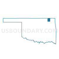
Outline

Summary
| Unique Area Identifier | 654537 |
| Name | Voting District 103 |
| County | Nowata County |
| State | Oklahoma |
| Area (square miles) | 84.50 |
| Land Area (square miles) | 74.40 |
| Water Area (square miles) | 10.10 |
| % of Land Area | 88.04 |
| % of Water Area | 11.96 |
| Latitude of the Internal Point | 36.68054480 |
| Longtitude of the Internal Point | -95.49340350 |
Maps


Graphs
Select a template below for downloading or customizing gragh for Voting District 103, Nowata County, Oklahoma


Neighbors
Neighoring Voting District (by Name) Neighboring Voting District on the Map
- Voting District 101, Nowata County, OK
- Voting District 15, Rogers County, OK
- Voting District 23, Rogers County, OK
- Voting District 302, Nowata County, OK
- Voting District 303, Nowata County, OK
- Voting District 304, Nowata County, OK
- Voting District 320, Craig County, OK
- Voting District 520, Craig County, OK
Top 10 Neighboring County Subdivision (by Population) Neighboring County Subdivision on the Map
- Oologah-Talala CCD, Rogers County, OK (7,180)
- Nowata CCD, Nowata County, OK (5,898)
- Chelsea CCD, Rogers County, OK (5,113)
- Vinita West CCD, Craig County, OK (2,718)
- New Alluwe CCD, Nowata County, OK (736)
Top 10 Neighboring Place (by Population) Neighboring Place on the Map
Top 10 Neighboring Unified School District (by Population) Neighboring Unified School District on the Map
- Oologah-Talala Public Schools, OK (9,115)
- Chelsea Public Schools, OK (6,634)
- Nowata Public Schools, OK (5,931)
- Oklahoma Union Public Schools, OK (2,950)
- Bluejacket Public Schools, OK (1,531)
- White Oak Public Schools, OK (941)
Top 10 Neighboring State Legislative District Lower Chamber (by Population) Neighboring State Legislative District Lower Chamber on the Map
Top 10 Neighboring State Legislative District Upper Chamber (by Population) Neighboring State Legislative District Upper Chamber on the Map
Top 10 Neighboring 111th Congressional District (by Population) Neighboring 111th Congressional District on the Map
Top 10 Neighboring Census Tract (by Population) Neighboring Census Tract on the Map
- Census Tract 1724, Nowata County, OK (4,512)
- Census Tract 508.02, Rogers County, OK (3,132)
- Census Tract 507.02, Rogers County, OK (2,948)
- Census Tract 3732, Craig County, OK (2,718)
- Census Tract 1723, Nowata County, OK (2,122)